
Topographic maps give you:
- location and shape of natural and man-made features
- relief (contours and spot heights)
- feature and road names (where available)
- cities, towns, and buildings
- roads, railways, bridges, and tunnels
- dams, parks, and other identifiable features
- legend, scale bar, map reference index, MGA grid, true north, magnetic north, and grid north.
Topographic maps are useful to:
- determine changes in elevation
- find the directional flow of the terrain
- locate lakes, rivers and other natural waterways.
How to order a map from the Landgate Topographic Map Series
Please note, orders may take up to 5 business days.
Step 1
Find your map name and number identifiers in one of two ways:
- Search our Coverage Index Map here. Identify the map area you require.
- Search for your area of interest in Locate.
Step 2
Choose the map scale you require. See our WA Topo series detailed below for the scale and area covered in each.
Step 3
Download our Topographic Maps Order Form. Complete it using the map identifiers you found, note the map scale you require, and email to us.
Map coverage and scale options
Select from our Landgate Topographic Map Series of WA to suit your requirements.
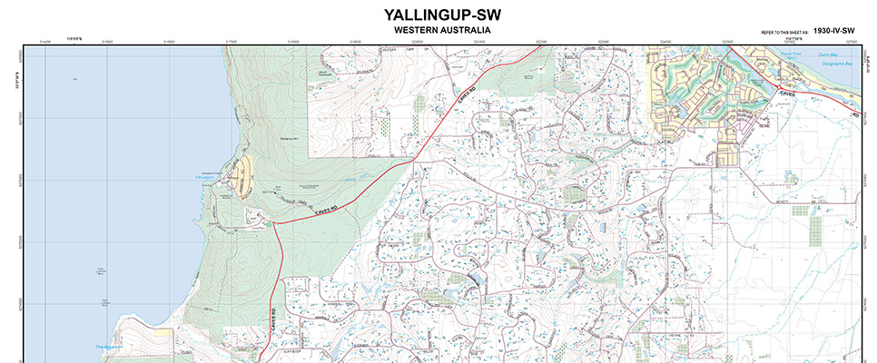
The WA Topo 25 series covers the Perth metropolitan area and selected state-wide areas at 1:25,000 scale where the level of feature density requires 1:25,000 scale mapping. Each sheet covers an approximate area of 7'30" longitude and 7'30" latitude which corresponds to approximately 14km by 12.5km at 5-10 metre contour intervals.
- coverage: Perth Metro, South West and selected state-wide areas
- scale: 1:25 000
- currency: 2023
- coordinates: MGA
- datum: GDA2020
- projection: UTM
- size: 810mm x 600mm
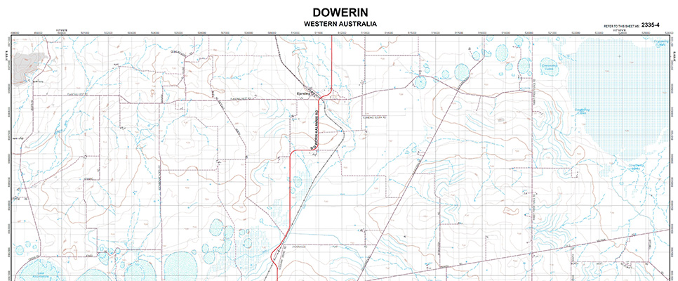
The WA Topo 50 series covers selected state-wide areas at 1:50,000 scale where the level of feature density requires 1:50,000 scale mapping. Each sheet covers an approximate area of 15' longitude and 15' latitude which corresponds to approximately 25km by 25km at 10-20 metre contour intervals.
- coverage: selected state-wide areas
- scale: 1:50 000
- currency: 2023
- coordinates: MGA
- datum: GDA2020
- projection: UTM
- size: 810mm x 600mm
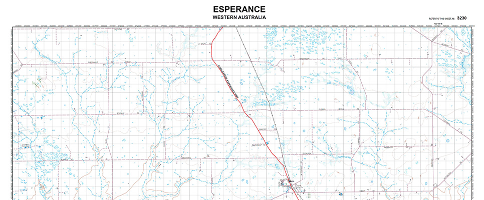
The WA Topo 100 series covers selected state-wide areas at 1:100,000 scale where the level of feature density requires 1:100,000 scale mapping. Each sheet covers an approximate area of 30' longitude and 30' latitude which corresponds to approximately 50km by 50km at 20 metre contour intervals.
- coverage: selected state-wide areas
- scale: 1:100 000
- currency: 2023
- coordinates: MGA
- datum: GDA2020
- projection: UTM
- size: 810mm x 600mm
Map prices
| Map Series | Format | Price |
| WA Topo 25 | PDF (locked, print enabled) | $15.40 |
| WA Topo 50 | PDF (locked, print enabled) | $15.40 |
| WA Topo 100 | PDF (locked, print enabled) | $15.40 |